- Thu 06 November 2003
- NewZealand
- Gaige B. Paulsen
- #travel
| Date: | 06.11.2003 |
| Start Location: |
Portobello Vacation Park |
| End Location: | Curio Bay Campground |
| Distance Driven | 263km (1,481km) |
Summary:
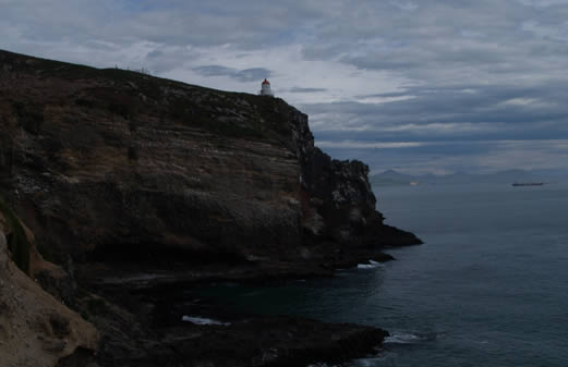
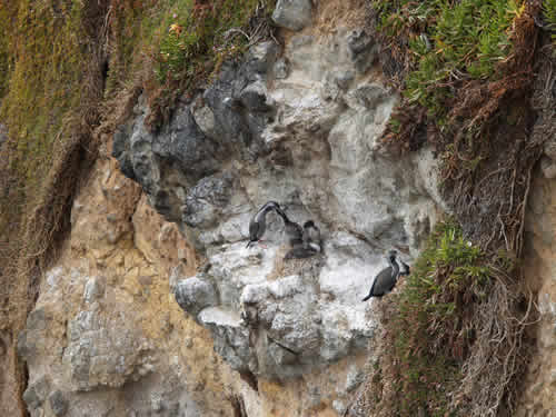
| Time: | 08:50 |
| Location: | Taiaroa Point |
| Name: | Albatross hunting |
| Description: | |
|
This morning we headed further east along the peninsula to Taiaroa Point, site of the only mainland Albatross colony in the world. Although we didn't see the Albatross, we did get a great view of the light house on the spot and have a cup of coffee and a scone for breakfast.
Nearby, a wide variety of other seabirds were nesting.
|
|
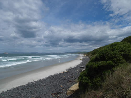
| Time: | 11:42 |
| Location: | Random Beach 45° 55.682' 170° 25.675' |
| Name: | Surfers, waves and flowers |
| Description: | |
|
After leaving the Otago peninsula, we headed south along the Southern Scenic Route, which wound around near the southern coast of the South Island, going from unsealed road to sealed road based on some function we could not determine. Along the route, we stopped at a beach to watch some surfers and their waves.
|
|
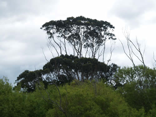
| Time: | 12:16 |
| Location: | 45° 56.799' 170°19.978' |
| Name: | Dr. Suess trees |
| Description: | |
|
After noticing these trees throughout the trip, we have been hunting for a good place to take some pictures of them. So far, the perfect place hasn't been forthcoming, but we did get a good shot today. Anyone who may know what kind of trees these are, please let us know. We just think that Suess would have liked them.
|
|
| Time: | 13:46 |
| Location: | Balclutha |
| Name: | Lunch and resupply |
| Description: | |
| Today's big shopping excursion occurred along the Southern Scenic Route in the town of Balclutha, on the Clutha River. The town is a quaint little place with a main street, a couple of traffic circles and a traffic light or two. We loaded fuel, LP Gas (part of our problem with the heater was solved by this), and bits and pieces for the food supply. We also grabbed a nice lunch in a pub here. | |
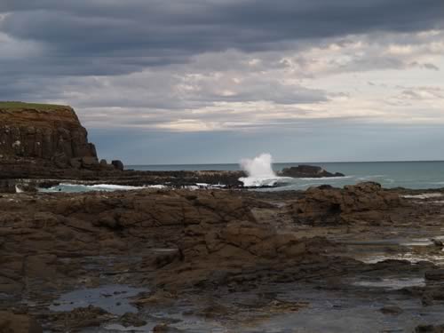
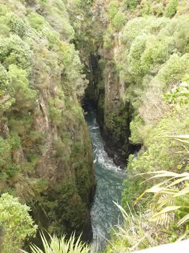
| Time: | 15:25 |
| Location: |
Jacks Blowhole |
| Name: | Jacks Blowhole Walk |
| Description: | |
|
After noticing it on the map, we decided to take a small detour from the Southern Scenic Route to Jacks Blowhole, a hole 55m deep and 200m away from the shore that is open to the air and also receives sea water via a tunnel. The effect is rather interesting, causing sea water to spray up the sides of the formation in rhythm with the waves.
|
|
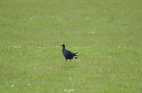
| Time: | 16:35 |
| Location: | Hinahina Road 46° 29.69' 169° 41.447' |
| Name: | Pukeko sighting |
| Description: | |
|
Mike caught a glimpse of these native birds with a keen eye (while I was reading the map). We then set out on three different attempts to get a good picture of the blue-breasted,red-topped indigenous bird.
|
|
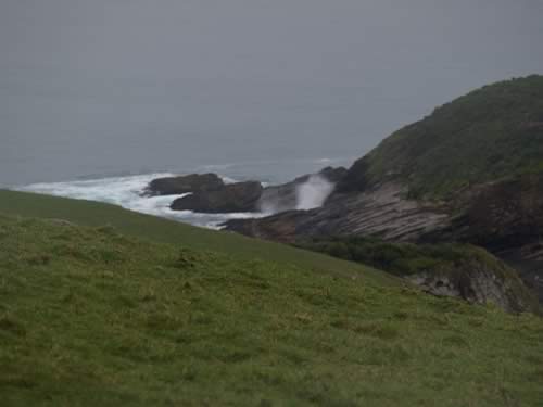
| Time: | 17:45 |
| Location: |
Spouting Cave |
| Name: | Crashing wave, hidden geyser |
| Description: | |
|
The Spouting Cave is on an island slightly offshore of the Southern Scenic Route. We stopped and spent a few minutes capturing the spectacular splashes of the waves against the island and the cave formation that gave the scenic spot its name.
|
|
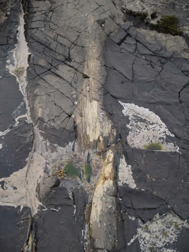
| Time: | 18:30 |
| Location: | Curio Bay |
| Name: | Petrified trees and splashing waves |
| Description: | |
|
We pulled in to our camp site this evening a little late and had a nice chat with the proprietor (whose sons live in New York and Australia and are both having girl problems). Once parked, we headed down the road to the Petrified Forest and took a look around at the remnants of the 180M year old trees that had fallen here and been turned to stone. Unlike the Petrified Forests in Yellowstone or Arizona, these are at the shore and have the added bonus of having waves crash upon them. Also, since they are embedded in the rock face, you are unlikely to steal them (at least not in one whole chunk).
While down hunting around for a good picture, we spotted a great wave spot which gave us plenty of material for photos as we stood there. Unfortunately, as we were walking amongst the trees, I feel and whacked my right hand and right knee. The camera is safe, and as far as I can tell I'm in a bit of pain from a big bruise, but that is it.
|
|