- Fri 07 November 2003
- NewZealand
- Gaige B. Paulsen
- #travel
| Date: | 07.11.2003 |
| Start Location: |
Curio Bay Campground |
| End Location: |
Te Anau Top 10 Mountain View Campground |
| Distance Driven | 373km (1,854km) |
Summary:
| Time: | 07:15 |
| Location: | Curio Bay Campground |
| Name: | It was a dark and stormy night |
| Description: | |
| We awoke this morning to a torrent of rain coming down in sheets with very high winds. Although the camper's relatively sheltered location (in amongst some tall grasses) kept us reasonably warm (also helped by the newly refueled heater), the morning's weather wasn't looking good and we decided to move out as quickly as we could so as to avoid letting the camper get bogged down in the grass. Today we were making a large trek to Te Anau and needed to make some good time. | |
| Time: | 07:50 |
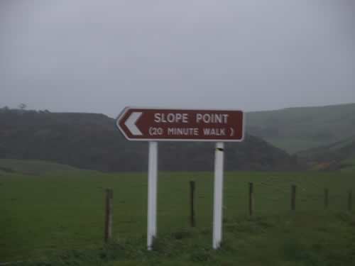
| Location: | Slope Point 46° 40.142' 169° 00.200' |
| Name: | North from here on out |
| Description: | |
|
Our first stop today was Slope Point, the southernmost point of the South Island. Although we didn't make it to the marker 20 minutes away (due to driving rain), we did get some pictures of the pointer to the point.
|
|
| Time: | 10:15 |
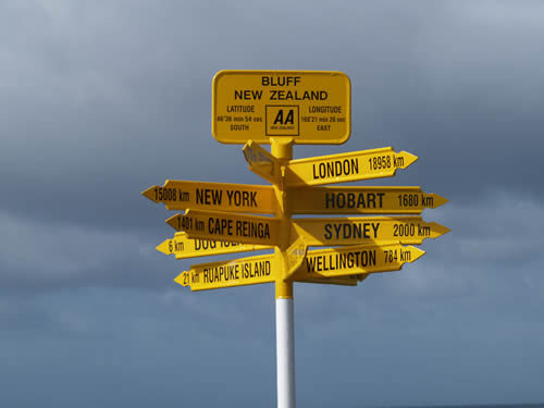
| Location: | Bluff |
| Name: | Breakfast |
| Description: | |
|
Bluff, southernmost point directly adjacent to Invercargill, was the site of our breakfast today. The eggs and toast were good, but the coffee and hot chocolate left a bit to be desired. However, by waiting out the rain in the warm café, we managed to get some better pictures of the international signage at the end of the road.
|
|
| Time: | 11:30 |
| Location: | Invercargill |
| Name: | Fixed Or Repaired Daily |
| Description: | |
|
About 9:00 this morning, our speedometer and odometer stopped running for about 30km. We don't know the cause and it did eventually come back. However, it doesn't change the fact that it was a bit troublesome. Thus, we made a stop at the Ford dealer in Invercargill for a quick look. The folks were courteous but baffled and sent us on our way. As a backup, we've switched the GPS to metric, so now we have a spedo if it goes out again. This downtime in a city with cellular service gave us an opportunity to check email and do the upload for day 6. |
|
| Time: | 12:50 |
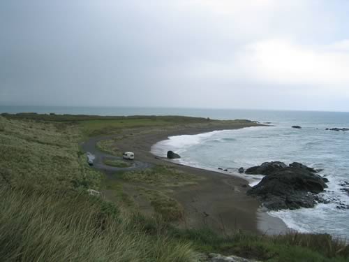
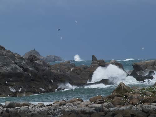
| Location: | The Rocks, Riverton 46° 23.009' 168° 01.971' |
| Name: | Fine for ducks |
| Description: | |
|
Continuing
our rain theme, we jumped out of the van at The Rocks to have a look
at the observation point as it was not raining. Of course, the fine weather
for ducks immediately resumed once we were mostly atop the lookout and
so we were drenched. Good thing we brought some additional clothes.
|
|
| Time: | 13:57 |
| Location: | Cosy Nook 46° 19.896' 167° 42.763' |
| Name: | You must mean Mullet Bay |
| Description: | |
|
Mike has a theory about tourist markers. Basically, he disbelieves them. It doesn't stop us from following darned near every one, but we go there with the full knowledge that we don't expect them to have anything to do with their labels. Cosy Nook was probably the killer in this regard. Billed as a "quaint settlement," we found 3 homes and a sign that indicated that Cosy Nook was not even Cosy Nook, it was Mullet Bay. Fortunately, that didn't stop us from finding some great waves breaking on a distant set of rocks.
Found on the outskirts of town: the remnants of an accident on Halloween:
|
|
| Time: | 14:50 |
| Location: |
McCrackens Rest |
| Name: | Scenic Vista |
| Description: | |
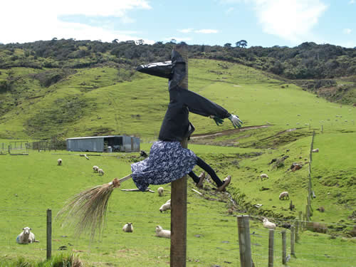
| After 7 days on the road, you would think that somewhat random scenic vistas would hold no allure. However, you have just not traveled with these two die hard travelers if this is the case. We will stop at every brown sign we see just to determine if there's anything there. In some cases, it has taken the better part of an hour to get out and back. Fortunately, this was not one such case, but considering that we have had some great visual rewards at these out-of-the-way places, we will continue to hunt them down. | |
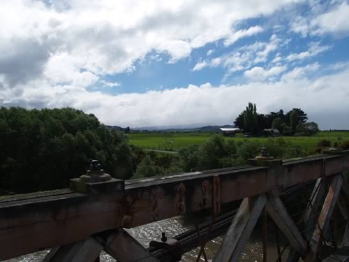
| Time: | 16:08 |
| Location: | Clifden Suspension
Bridge 46° 1.729' 167° 42.912' |
| Name: | Full flow and then some |
| Description: | |
|
One of the nice surprises was the Clifden Suspension Bridge. This site, located a mere 300m from the main road, is a suspension bridge originally opened in 1899. It's a sturdy bridge over what is usually a fairly calm river (the Waiau). In 1976, a hydro plant was built upstream that cut the flow from 400 cumecs (cubic meters per second) to around 1 cumec. This was later "fixed" through an agreement and the construction of another dam to a more sustainable 12-16 cumecs. Well, today we got to see the river from bank to bank due to the rain conditions.
|
|
| Time: | 16:31 |
| Location: | Clifden Gorge 46° 1.078' 167° 44.499' |
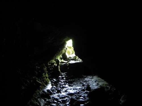
| Name: | An unexpected cave treat |
| Description: | |
|
While heading north to Te Anau, we made a quick detour to follow the sun around a hill that looked intriguing. We got a nice picture or two of that hill and the one behind it, but on the way back noticed a small sign pointing to the right at "Limestone Cave." Intrigued, we ventured a couple of kms up the road to a pull-off. It turns out, this is a reasonable size public cave that stretches for 300m to the first point and probably a kilometer or more to the exit. We weren't prepared to do too much investigation, but a quick trip into the darkness before it became crawl-only was enjoyable (and about all my claustrophobic head could handle).
|
|