- Wed 05 November 2003
- NewZealand
- Gaige B. Paulsen
- #travel
| Date: | 05.11.2003 |
| Start Location: | Kelceys Bush Vacation
Park S: 44° 42.255' E: 170° 58.451' |
| End Location: |
Portobello Vacation
Park |
| Distance Driven | 332km (1,218km) |
Summary:
| Time: | 05:30 |
| Location: | Kelceys Bush Vacation
Park S: 44° 42.255' E: 170° 58.451' |
| Name: | Sunrise photo session |
| Description: | |
|
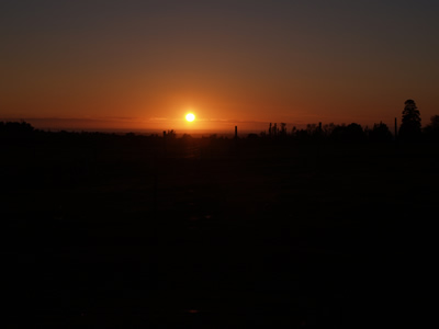
After awakening in the still-cold camper van, I dragged myself out of bed at 5:30am to get pictures of the area during the sunrise. It was more difficult than expected due to the specific location of the sun relative to our campsite, but I think it worked out for a couple of the photos.
|
|
| Time: | 08:30 |
| Location: | Kelceys Bush Walk |
| Name: | Walk to Kelceys Bush |
| Description: | |
|
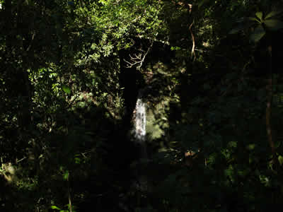
Kelceys bush is a "natural" area containing native wildlife and some wallabys that are decended from a breeding pair let loose in the areas decades ago. The walk was pleasant enough, with a small waterfall and some beautiful ferns and flowers, but didn't last particularly long.
|
|
| Time: | 11:44 |
| Location: | On Backline Road S: 44° 25.87' E: 170° 54.05' |
| Name: | Farming beauty |
| Description: | |
|
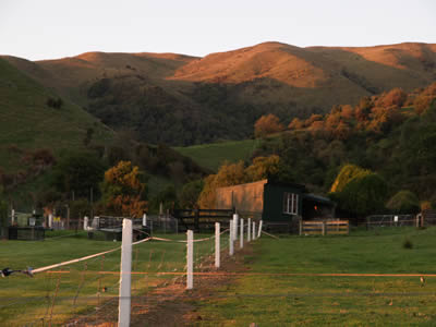
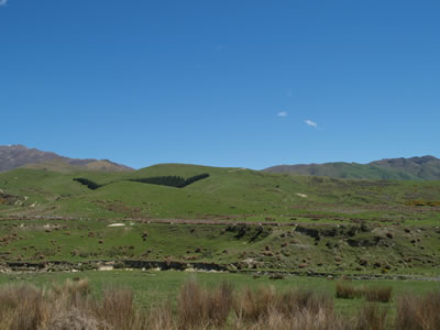
This is another shot of some farms along the way between the Mt. Nimrod Scenic Reserve and Timaru.
|
|
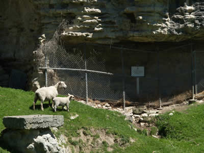
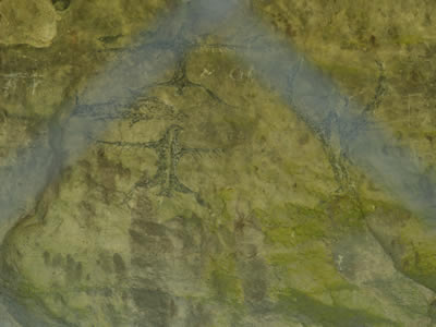
| Time: | 12:15 |
| Location: | Between Motukaika and Timaru |
| Name: | Maori Rock Drawings |
| Description: | |
|
We stopped at a set of rock drawings along our way from Mt. Nimrod back to Timaru for lunch. The drawings themselves are interesting, but the electric fence that needed to be traversed "at your own risk" was equally so, as were the sheep guarding the way.
|
|
| Time: | 13:20 |
| Location: | Timaru |
| Name: | Lunch |
| Description: | |
| We pulled over in Timaru to get lunch (and breakfast, for that matter) at a local pub and refill on fuel and cash. The pub was cheap and the food was good. Nice combination after some of the meals that we have had on the trip. On balance, we'd eat there again. | |
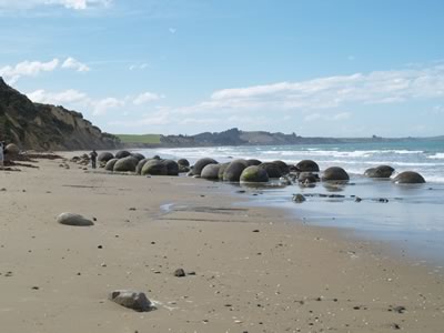
| Time: | 16:34 |
| Location: | Moeraki S: 45° 21.324' E: 170° 49.533' |
| Name: | Moeraki Boulders |
| Description: | |
|
After passing over the 45th parallel (the other one), we headed south on NZ1 towards Dunedin. Our first stop was at Moeraki, where there are a series of boulders deposited on the beach which are nearly round. The boulders are not necessarilly unique in the world, but they are definitely interesting. Theory states that they were formed over time when the local mud solidified into rock and then was eroded away by the sea.
|
|
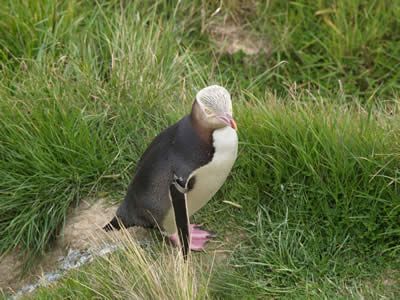
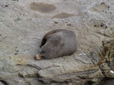
| Time: | 16:50 |
| Location: | Shag Point/Matakaea |
| Name: | Seals and Pengiun |
| Description: | |
|
Our last touristy stop for the day was at Shag Point, which is supposed to be home for seals and yellow-eyed penguins. The billing did not disappoint. Although we saw only one of the birds, we were able to get close enough to provide some excellent pictures.
|
|
| Time: | 18:30 |
| Location: | Portobello |
| Name: | Dinner and sleep |
| Description: | |
| We arrived a bit late this evening and quickly grabbed a bite at the 1803 Cafe in Portobello and then headed off to sleep. | |