- Tue 04 November 2003
- NewZealand
- Gaige B. Paulsen
- #travel
| Date: | 04.11.2003 |
| Start Location: |
Mount Cook |
| End Location: |
Kelceys Bush Camp Site |
| Distance Driven | 296km (880.6km) |
Summary:
| Time: | 05:30 |
| Location: | White Horse Campgrounds |
| Name: | Sunrise over the Mountains |
| Description: | |
|
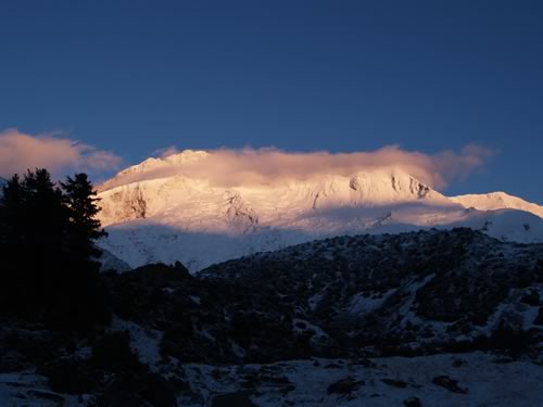
After a frigid night which left the entire landscape (including our camper van) covered with a couple of cm's of snow, I awoke around 05:30 noticing a glint of sunshine coming in from under the curtains to the cab. Sighting an opportunity to go and take some photos, I bundled up (it was already 41° inside of the van, so it was clearly colder outside). With about an hour wandering around the quiet and snow-covered landscape, I managed to get off about 88 pictures –one of which, hopefully, is good.
|
|
| Time: | 09:00 |
| Location: | Tasman Valley |
| Name: | Tasman Glacier Hike |
| Description: | |
|
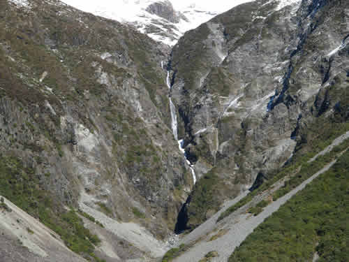
After finishing a huge (and too expensive) breakfast, we headed out to Tasman Valley to go see the glacier. Looking at the map, it appeared to be our best bet at actually coming close to one in the Southern Alps (there will be more chances when we are on the west side of the island). The drive was pretty and we happened across a cascade of waterfalls that looked absolutely gorgeous.
The glacier was interesting, as it was mainly covered by a few feet of debris. There was the usual occasional iceberg floating in the lake, to remind us that there is actually ice under the rock and you can see it if you look closely.
|
|
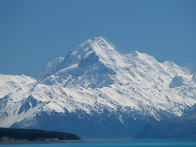
| Time: | 12:30 |
| Location: | Mount Cook Visitor Center |
| Name: | Another shot at the mountains |
| Description: | |
|
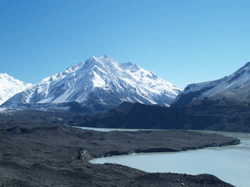
Today, the weather cooperated and we were able to get some much better pictures of Mt. Cook and other mountains in the area without all of the cloud cover that plagued us the day before.
|
|
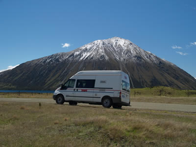
| Time: | 13:53 |
| Location: | Lake Ohau |
| Name: | Yet another pretty lake |
| Description: | |
|
After leaving the Mount Cook area and heading south, we drove through Twizel and picked up miscellaneous supplies and fuel. Coming out of the town, we moved on to Lake Ohau, another beautiful lake with surrounding mountains. The area is used for skiing in the winter (season having just ended) and in the summer as a watersport area. We approached in our van and then headed on. For those of you with interest, here is a picture.
|
|
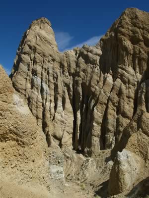
| Time: | 14:47 |
| Location: |
Clay Cliffs |
| Name: | Erosion can be fun |
| Description: | |
|
While travelling NZ8 down towards Wakitata, we noticed a sign for Clay Cliffs and decided to go track it down. Continuing our theme of dragging the camper van over rough terrain, this trek involved a significant chunk of gravel road, some of which was pretty ugly. In the end, the views were very nice. The area is made of clay with erosion effects that have carved channels and made geological formations. As you can see, the light is a bit cheeky here, but the sights were good.
|
|
| Time: | 13:45 |
| Location: | Benmore Dam |
| Name: | Big hydro |
| Description: | |
|
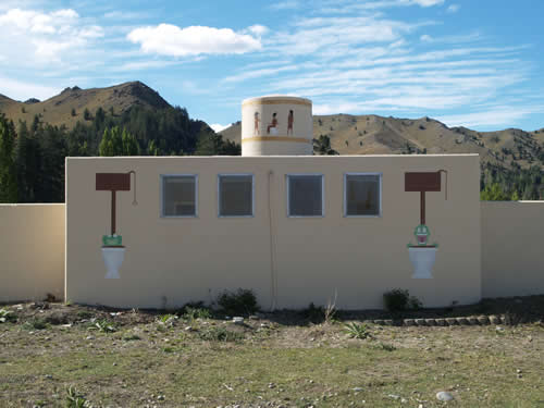
For those who don't know, about 70% of the power in New Zealand comes from hydroelectric facilities, much of it on the South Island. We stopped by the visitor center at Benmore Dam and got an education in the facility and its sister facilities along the Waitaki River. The combination of six lakes and eight facilities provides about 3.6GWh of power per year, or about 1,000kWh per Kiwi. However, although the dam was pretty, the most visually stunning part of the scenery was the lavatories, featured below:
|
|