- Thu 20 November 2003
- NewZealand
- Gaige B. Paulsen
- #travel
| Date: | 20.11.2003 |
| Start Location: |
Kaiteriteri |
| End Location: |
Picton |
| Distance Driven | 211km (5217km) |
Summary:
| Time: | 09:00 |
| Location: | Kaiteriteri S: 41° 02.176' E: 173° 01.052' |
| Name: | Depart for Coastal Track |
| Description: | |
|
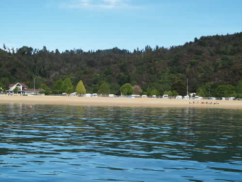
Mike and I went our separate ways for the day today, he went off in search of acceptable sea kayaking adventures, and I left on a water taxi to go hike the Coastal Track for Abel Tasman. The water taxi was enjoyable, but a bit brisk. There craft was nearly full and the captain and his mate were pleasant and knowledgeable. After a quick stop to pick up a couple and a sea kayak, we took a quick forty-five minute tour up the coast to my departure point, Torrent Bay (where the Torrent River comes in to Tasman Bay). Once there, I waded ashore and began my trek south towards the entrance to the park that we had visited yesterday. Based on the locations of the sea kayaking outfits and the trails available, we decided this would be the right meeting point—besides, they had food, drink, and cheap internet service if one of us beat the other there.
|
|
| Time: | 09:45 |
| Location: | Torrent Bay |
| Name: | Abel Tasman Coastal Track |
| Description: | |
|
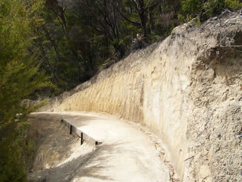
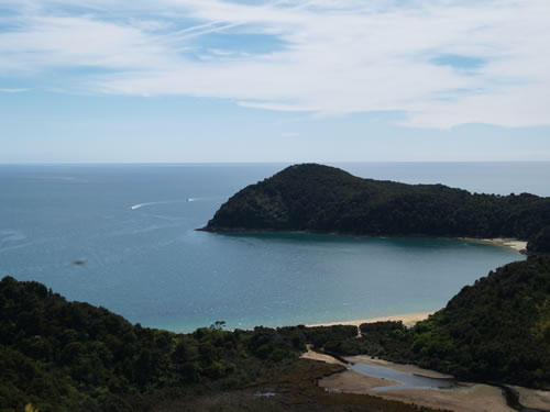
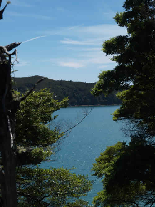
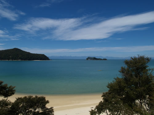
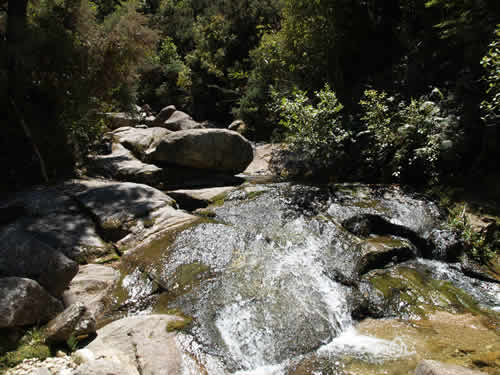
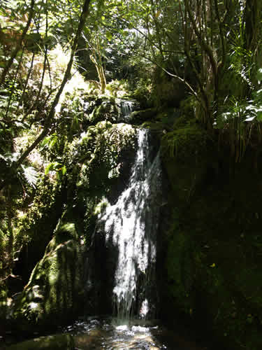
After leaving the boat, I followed the trail south some 18km, making a number of side stops and greeting fellow travelers along the way. The trail was a bit more populated than I had expected, considering that we are not yet in high season and the kids here in NZ are still in school. I imagine that it is quick jammed during the summer months, starting around Christmas and heading into February. The walk itself is mostly along the beaches, but up in the hills. As such, you cannot see the beaches themselves very often without taking smaller tracks (usually 15 minutes or less) down to them. However, there are some wonderful views of the bays and the islands that dot the coastline of New Zealand's smallest and most heavily used national park.
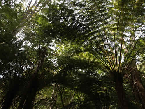
Ferns...
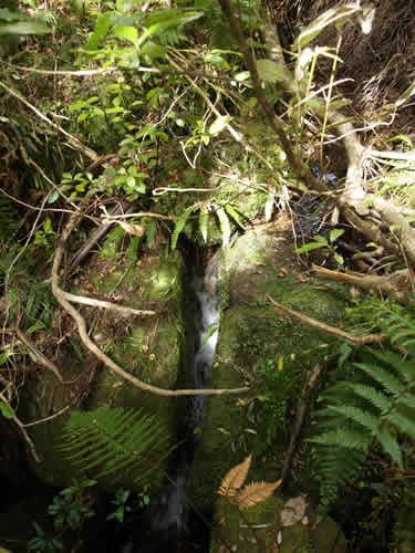
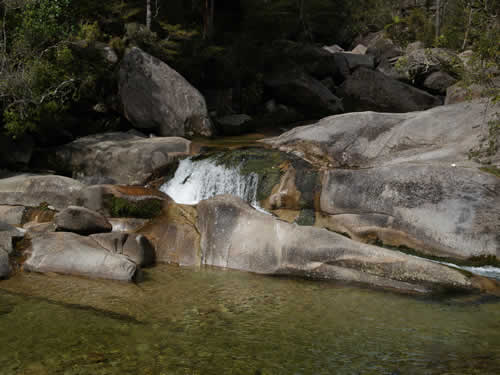
and falls.
Can you see Cleopatra in her pool?
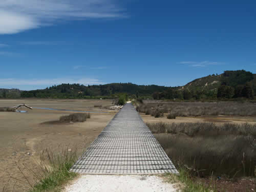
Paths chiseled from the sand
|
|
| Time: | 13:30 |
| Location: | The Park Café |
| Name: | The end of the hike |
| Description: | |
|
After a good long walk, I settled down in the Café to have a little refreshment and wait for Mike, who arrived just as I was in the middle of eating my lunch. He ordered something and we sat for another half hour or so recounting the days events and preparing to head to Picton for our overnight stay before the ferry in the morning.
Final walk to the Café and out of the park. |
|
| Time: | 18:00 |
| Location: | Picton |
| Name: | The last night in the campervan |
| Description: | |
|
Tonight is our last night with both of us in the campervan. Tomorrow evening, I will bid farewell to a fine driver and a good friend and wish him luck as he travels the North Island on his own for the next couple of weeks. I am destined for a flight to Melborne to visit my cousin and her husband for the weekend before heading back to the States. We have a long (600km) drive ahead of us once we arrive in Wellington tomorrow, so I'm not expecting a lot of sleep tomorrow evening, but it will be nice to sleep in a real bed with a bathroom and shower in the room. The trip through the South Island, encompassing more than 5000km and taking just under three weeks has been a great experience. I feel that we have in many ways gotten a good taste of the flavor of New Zealand, but have just scratched the surface of all that it has to offer. The last part of the trip was the most unexpected for me, as I thought of New Zealand primarily as a land of mountains, sheep, and rain. For much of the Island, that appeared to be the right of it, although we have had some good weather in almost every quadrant. However, Abel Tasman was a bit of an unexpected pleasure for me, with sand beaches replacing the gravel beaches we had walked in much of the country and warm, sunny days replacing the drizzle. Of course, the sheep and forested trees are omnipresent, giving rise to Mike's favorite phrase about New Zealand, stating that it is "pasturized". Indeed, it appears that all arable land has been set aside for sheep or cows and that nearly every mountainside is covered with rows and rows of non-native pine that are on their way to becoming 2x4's some time in the future. |
|