- Wed 19 November 2003
- NewZealand
- Gaige B. Paulsen
- #travel
| Date: | 19.11.2003 |
| Start Location: |
Kaiteriteri |
| End Location: |
Kaiteriteri |
| Distance Driven |
296km (5006km) |
Summary:
| Time: | 10:01 |
| Location: | Marahao - Park Café S: 40° 49.799' E: 173°0.288' |
| Name: | Breakfast at Abel Tasman |
| Description: | |
|
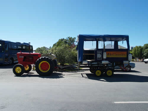
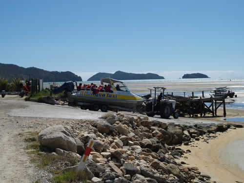
After our experience with a mighty slow dinner last night at the campervan park, we decided that breakfast should be had elsewhere. In this case, we started our drive at a bit before ten and headed up to the first Abel Tasman park entrance. At this entrance, there is a visitors centre and the Park Café, which is where we dined. The spot was notable for a number of things, not the least of which was our first interaction with the park, but also a pretty good breakfast, great coffee, and a cockatiel present on the premises, attached mostly to the bartender. Outside, we find two interesting vehicles, an award winning tour bus, and the Aqua Taxi. Try to figure out why we thought each of these was funny in its own right.
Hint: the text of the sign says: "New Zealand Tourism Awards 2000 Winner" Even when the weather is fine, Kiwis are prepared for sudden rain. |
|
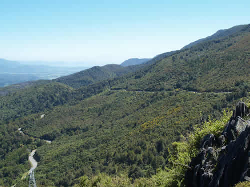
| Time: | 11:23 |
| Location: |
Harwood Lookout |
| Name: | Another long and winding road |
| Description: | |
|
New Zealand appears to, as a country, dislike the idea of tunnels. However, to compensate, they love to have long, windy roads, with one line bridges, going up the sides of mountains.
|
|
| Time: | 12:54 |
| Location: | Farewell Spit Visitor's
Centre S: 40°31.300' 172°44.472' |
| Name: | Farewell Spit |
| Description: | |
|
Farewell Spit is the target of many arctic migratory birds and is considered to be an important wetland internationally because of this. Most of the spit is formed by a series of crescent-shaped sand dunes along its 26km length. When the tide is high, some of the areas between the dunes fill in. When it is low, the area "behind" the spit (towards Golden Bay) is a large salt marsh, providing an excellent habitat for these fowl. Unfortunately, access to the Spit is highly limited and we were only as close as the Visitor's Centre, which can only give you a small glimpse of this interesting feature.
More unfortunately, the Spit also has a reputation as a location for whales to beach themselves. The Visitor's Centre was littered with photographs from beachings (mostly Pilot Whales) in the last few decades. |
|
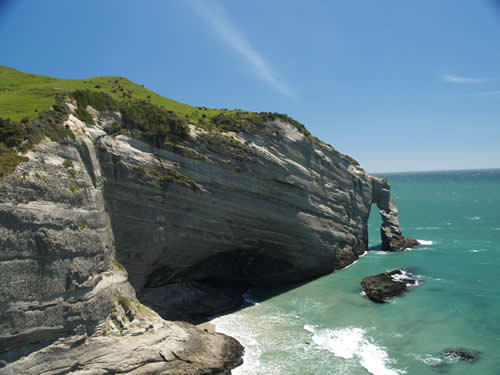
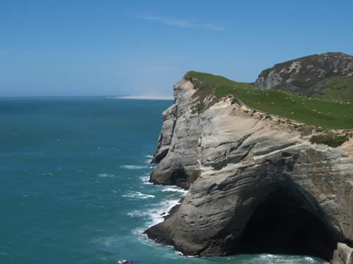
| Time: | 13:26 |
| Location: | Cape Farewell S: 40° 30.140' E: 172°41.907' |
| Name: | Northernmost point on the South Island |
| Description: | |
|
A short drive and a short hike from Farewell Spit takes you to Cape Farewell, the northernmost point on the South Island. Having been within eyeshot of the southernmost point, we thought it appropriate to hike up to the northernmost point (which has much nicer weather). The point itself was interesting, but the rock formations around it were awesome. Below find some of the sea caves around the area, and if you look very closely, you might see a seal or two.
If you look closely at the horizon on the second photo, you can see sand rising from the dunes on Farewell Spit. |
|
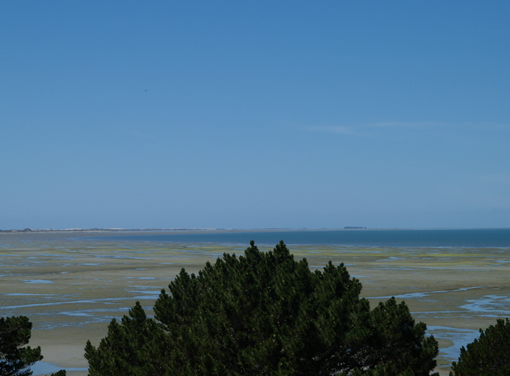
| Time: | 14:22 |
| Location: | Golden bay |
| Name: | Big salt flat |
| Description: | |
|
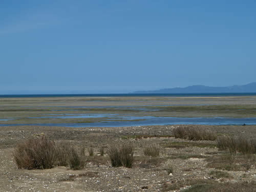
I'll grant that the Golden Bay isn't the most beautiful place in the world when the tide is out. However, from the perspective of the many migrating birds, it is an essential part of their ecosystem.
|
|
| Time: | 15:02 |
| Location: | Pupu Springs |
| Name: | One large spring |
| Description: | |
|
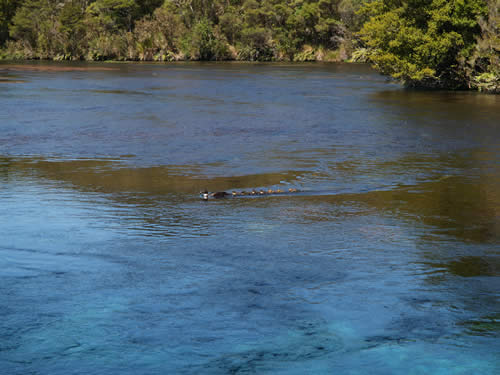
From the Golden Bay, we headed back down to Takaka to visit Pupu Springs, New Zealand's largest freshwater spring, and reportedly one of the cleanest springs in the world. The spring is large (pushing out about 500 million gallons of water a day), but as far as we can tell, not in the running for largest in the world. Not surprisingly, it has a prominent place in Maori lore, and there were signs at every viewing point reminding visitors not to foul the water, as it would be an affront to the Maori people. Throughout New Zealand, we have heard the phrase, "fine weather for ducks," this spring truly is a fine place for ducks.
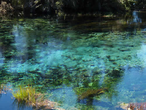
One of the other interesting features of the spring complex is the Dancing Sands Spring, which appears to cause the surrounding sands to dance. Not easy to show in a still, but it is still a pretty sight.
|
|
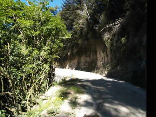
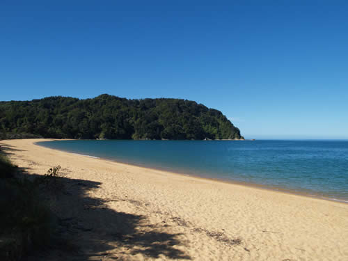
| Time: | 16:50 |
| Location: | Totaranui |
| Name: | Long road, pretty beach |
| Description: | |
|
Our final intentional destination for the day was Totaranui, the northernmost campervan park in the Abel Tasman shoreline park system. Totaranui is reachable by car, but only barely. The road to it climbs over an 800 ft pass and is comprised mostly of compacted coastal sand. To put this into perspective, people were carving their initials with their fingers into the side of the "mountain" next to the road. Adding to the fun is the usual New Zealand penchant for one-lane and near-one-lane roads.
After all of that, we got to the beach. Although very pretty, Mike was a bit disappointing, stating that after that drive, he was hoping to be awe-struck.
|
|