- Sun 16 November 2003
- NewZealand
- Gaige B. Paulsen
- #travel
| Date: | 16.11.2003 |
| Start Location: |
Hanmer Springs Top 10 Mountain View |
| End Location: |
Westport Top 10 Holiday Park |
| Distance Driven | 313km (3691km) |
Summary:
| Time: | 11:08 |
| Location: | Hanmer Springs Top
10 Mountain View S: 42° 31.674' E: 172° 49.885' |
| Name: | Depart for points West |
| Description: | |
|
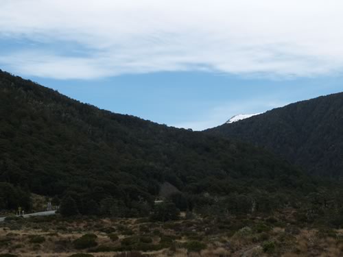
After recovering from the loss of "our team" the All Blacks, we got up late, uploaded yesterday's pictures, checked our various email messages and left for the day. The weather looked pretty variable (read "fine for ducks") in all directions, so we decided to head back to the West Coast in hopes that we would find something more enticing there. Here is a picture of the blue sky tease that the mountains gave us this morning:
|
|
| Time: | 14:41 |
| Location: | Greymouth S: 42° 26.971' S: 171° 12.603' |
| Name: | Lunch |
| Description: | |
| After a number of hours of rainy driving, we stopped off at Greymouth to get some lunch. The town is relatively large (the largest in this part of the country) at almost 14,000 people. However, it was Sunday, so that number of places serving food in the middle of the afternoon was limited. | |
| Time: | 15:53 |
| Location: | S: 42° 22.152' E:
171° 14.663' S: 42° 21.030' E: 171° 15.290' S: 42° 20.126' E: 171° 15.829' S: 42° 18.853' E: 171° 16.807' |
| Name: | Northward on NZ6 |
| Description: | |
|
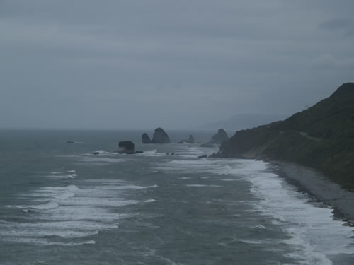
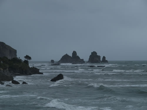
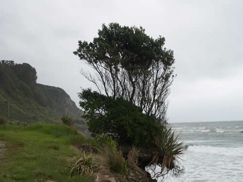
After lunch at Greymouth, we headed North up the West Coast. The road runs right on the cast most of its length, so it gives some wonderful ocean vistas. Unfortunately, the rain was still with us, so it was limiting our views of the Tasman and the beautiful rock formations along the coastline. When the rain died down, we had to contend photographically with some very limited vantage points. Although there were many spectacular views from the road, oft times we couldn't get to the same viewpoint from a safe location on the ground. However, here are a few of the formations that took our fancy:
|
|
| Time: | 17:08 |
| Location: | Punakaiki S: 42° 06.908' E: 171° 19.784' |
| Name: | Pancakes and blowholes |
| Description: | |
|
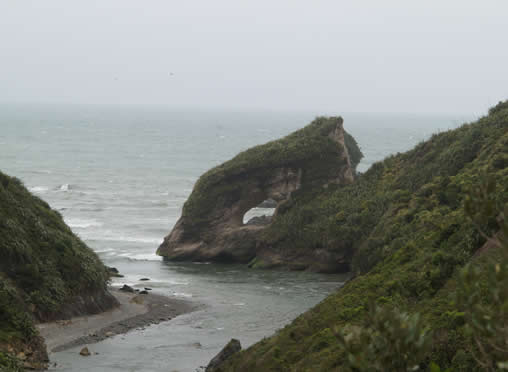
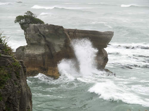
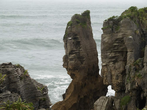
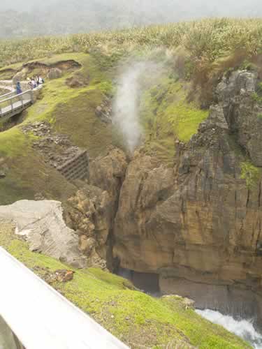
Punakaiki, in the Paparoa National Park, is an area of coastline that is dominated by large limestone formations that look like pancakes that have been piled one atop each other out of the sea. Besides providing an interesting texture, the rocks have eroded in such a fashion as to cause a number of blowholes which spurt seawater during high tide. Lucky for us, we have landed at the coast at high tide almost every time we have shown up there. Unfortunately, in the past, it has prevented us from seeing sights that are only visible at low tide (a number of tunnels and caves, and a ship that is believed wrecked off shore). However, this time, our high tide arrival was just what was necessary to maximize the viewing experience. We braved the rain to go snap pictures of both the "pancakes" and the blowholes, some of which you will find here.
|
|
| Time: | 19:25 |
| Location: | Westport Top 10 Holiday
Park S: 41° 45.097' E: 171° 36.742' |
| Name: | Arrival for the night |
| Description: | |
| We pulled into the Westport Top 10 Holiday Park about 7:25pm. After checking in, we got right to the email and web work, in preparation for sleep and with hopes for sun tomorrow. | |