- Mon 10 November 2003
- NewZealand
- Gaige B. Paulsen
- #travel
| Date: | 10.11.2003 |
| Start Location: |
Manapouri Lakeside Motor Park |
| End Location: | Aspiring Campervan
Park, Wanaka S: 4° 42.331' E: 169° 5.418' |
| Distance Driven | 266km (2372km) |
Summary:
| Time: | 09:30 |
| Location: | Manapouri Store |
| Name: | Breakfast and departure |
| Description: | |
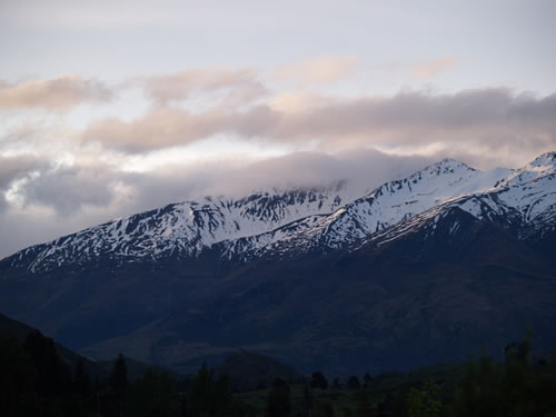
| Today we headed north to Queenstown (self-proclaimed "adventure capital of the world") and Wanaka. But first, time to fuel the van and the occupants. A decent breakfast with bad coffee was had at the Manapouri Store and then we were off on NZ94 to points north. The entire drive was pretty, with the expected sheep and some unexpectedly nice mountains. By way of explanation, it isn't that it is unexpected that New Zealand would have beautiful mountains, just that after 10 days of roaming around in them, we'd still notice. The usual contingent of sheep and cattle were to be seen nearly everywhere (excepting the Red Tussock Preserve along a section on NZ94. | |
| Time: | 11:05 |
| Location: | Fairlight Station |
| Name: | All aboard! |
| Description: | |
|
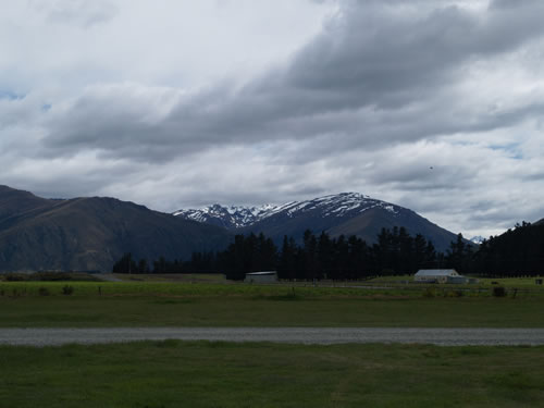
Owing to a lack of safe spots to pull off, most of the morning's drive has been without pictures. However, with the approach of Fairlight, this was to change. Most of NZ6 up to that point had been narrow and without the usual pull-offs and picnic benches. Fairlight station is one end of the Kingston Flyer Railroad, a steam locomotive that runs a few times per day down a 14km track for tourists. For us, though, it provided an opportunity to get out and preview things to come.
|
|
| Time: | 11:20 |
| Location: |
Lake Wakatipu |
| Name: | Laka Wakatipu approach |
| Description: | |
|
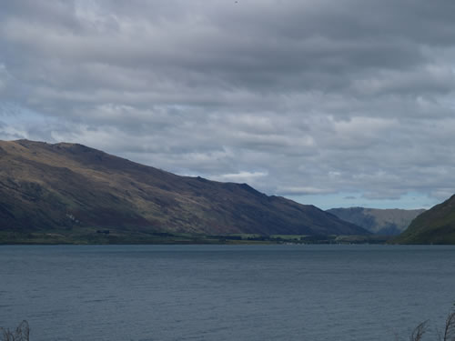
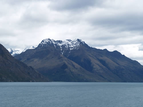
Queenstown is situated at a bend in Lake Wakatipu. On our way there, we passed Kingston (at one end of the lake) and headed up the eastern side of the bay, past the Hector Mountains and the Remarkables. During this drive, we stopped about every 5-10 minutes for photos and to stretch our travel-weary legs.
|
|
| Time: |
12:10 |
| Location: | Queenstown S: 45° 01.850' E: 168° 39.695' |
| Name: | Lunch and tourism |
| Description: | |
|
We stopped in Queenstown at about lunch time, which was fortuitous, as we were hungry for lunch. We surveyed the town and it is a nice enough place if you like touristy towns aimed at adventure tourism. However, it was much too commercialized for us at this point. After having spent two weeks roaming New Zealand's South Island where most towns barely reach double-digit populations (ok, but to be serious, very few have been larger than 100), this many people in such a commercial setting was a bit too much. We decided to grab lunch at a little Thai place (good food, but not spicy enough) and then headed further north to Wanaka. |
|
| Time: | 14:10 |
| Location: |
Kawarau Bridge |
| Name: | Go ahead and jump! |
| Description: | |
|
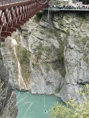
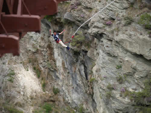
Being in New Zealand would not be complete without some experience with Bungy jumping. The "sport" originated with the Kiwi's in the 20th century when a couple of crazy blokes took a flying leap off of the Eiffel Tower. After that, they came back to Queenstown and started a company jumping people off of the historic Kawarau Bridge. Here are pictures of Mike and I jumping:
Uh-huh... did any of you folks actually believe that? |
|
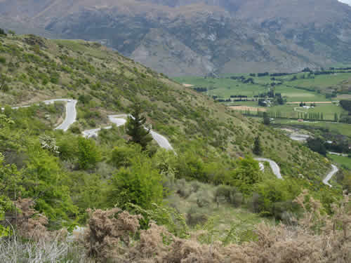
| Time: | 14:40 |
| Location: |
Scenic Lookout |
| Name: | The long and winding road |
| Description: | |
|
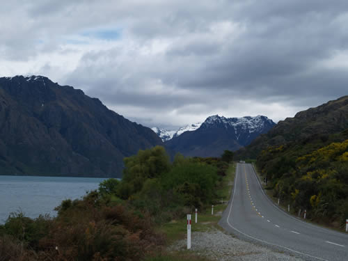
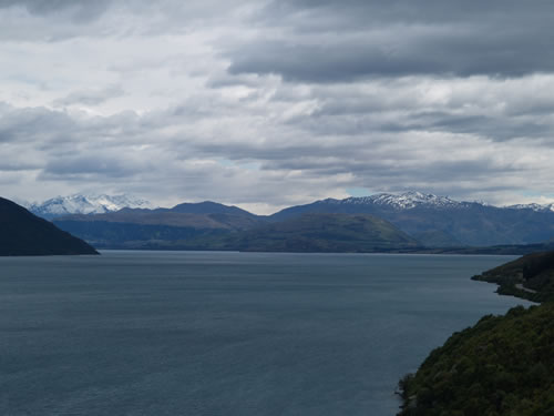
There are two roads to Wanaka from Queenstown, the long flat road and the "shorter" windy track through the mountains. We, of course, chose the latter. Fortunately, we were given an opportunity to document the route by a lookout at the top of the first set of switchbacks.
|
|
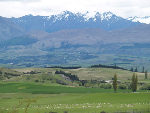
| Time: | 14:55 |
| Location: | S:44° 58.868' E: 168°
53.949' S:44° 46.553' E: 169° 05.418' |
| Name: | Agriculture on the hoof |
| Description: | |
|
It was pointed out to me that it certainly didn't look like there were 48 million sheep here and a large number of other critters, due to the near total lack of appearance in my photo log. Thus, here are a couple to set the record straight:
(the white dots at the bottom of this one are all sheep)
|
|
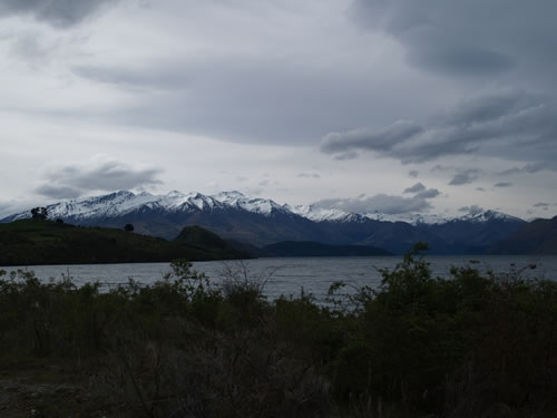
| Time: | 1621 |
| Location: | Aspiring Campervan
Park, Wanaka S: 4° 42.331' E: 169° 5.418' |
| Name: | Walk to Waterfall Creek |
| Description: | |
|
Since we'd spent most of the day in the car, a walk down to Laka Wanaka was in order. Mike found a track pointed at something called Waterfall Creek and we headed out that way. Unfortunately, waterfalls were not to be found on the walk, but it was a nice hour and a half brisk walk and we have some pictures of the Lake Wanaka area to show for it. It is no wonder this is considered to be a nice vacation spot.
|
|
| Time: | 20:30 |
| Location: | Aspiring Campervan
Park, Wanaka S: 4° 42.331' E: 169° 5.418' |
| Name: | Sunset |
| Description: | |
|
Time to wrap it up and go to sleep.
|
|